


Family Maps of Sanilac County, Michigan
Family Maps of Sanilac County, Michigan
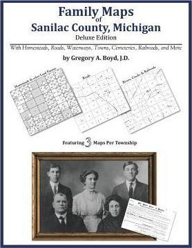
334 pages with 98 total maps Locating original landowners in maps has never been an easy task-until now. This volume in the Family Maps series contains newly created maps of original landowners (patent maps) in what is now Sanilac County, Michigan, gleaned from the indexes of the U.S. Bureau of Land Management. But it offers much more than that. For each township in the county, there are two additional maps accompanying the patent map: a road map and a map showing waterways, railroads, and both modern and many historical city-centers and cemeteries. Included are indexes to help you locate what you are looking for, whether you know a person's name, a last name, a place-name, or a cemetery. The combination of maps and indexes are designed to aid researchers of American history or genealogy to explore frontier neighborhoods, examine family migrations, locate hard-to-find cemeteries and towns, as well as locate land based on legal descriptions found in old documents or deeds. The patent-maps are essentially plat maps but instead of depicting owners for a particular year, these maps show original landowners, no matter when the transfer from the federal government was completed. Dates of patents typically begin near the time of statehood and run into the early 1900s. What's Mapped in this book (that you'll not likely find elsewhere) . . . 3454 Parcels of Land (with original landowner names and patent-dates labeled in the relevant map) 49 Cemeteries plus . . . Roads, and existing Rivers, Creeks, Streams, Railroads, and Small-towns (including some historical), etc. What YEARS are these maps for? Here are the counts for parcels of land mapped, by the decade in which the corresponding land patents were issued: DecadeParcel-count 1830s364 1840s184 1850s1549 1860s828 1870s348 1880s144 1890s26 1900s3 1910s6 1920s2 What Cities and Towns are in Sanilac County, Michigan (and in this book)? Amadore, Applegate, Argyle, Austin Center, Birch Beach, Blue Water Beach, Brown City, Carsonville, Cash, Charleston, Croswell, Cumber, Decker, Deckerville, Elmer, Forester, Forestville, Freidberger, Great Lakes Beach, Hemans, Huronia Heights, Juhl, Laing, Lexington, Lexington Heights, Marlette, McGregor, Melvin, Minden City, New Greenleaf, Palms, Peatville, Peck, Pine Hill (historical), Port Sanilac, Richmondville, Roseburg, Sandusky, Shabbona, Snover, Speaker, Tyre, Valley Center, Watertown, Wickware
PRP: 270.86 Lei
Acesta este Pretul Recomandat de Producator. Pretul de vanzare al produsului este afisat mai jos.
243.77Lei
243.77Lei
270.86 LeiPrimesti 243 puncte

Livrare in 2-4 saptamani
Descrierea produsului
334 pages with 98 total maps Locating original landowners in maps has never been an easy task-until now. This volume in the Family Maps series contains newly created maps of original landowners (patent maps) in what is now Sanilac County, Michigan, gleaned from the indexes of the U.S. Bureau of Land Management. But it offers much more than that. For each township in the county, there are two additional maps accompanying the patent map: a road map and a map showing waterways, railroads, and both modern and many historical city-centers and cemeteries. Included are indexes to help you locate what you are looking for, whether you know a person's name, a last name, a place-name, or a cemetery. The combination of maps and indexes are designed to aid researchers of American history or genealogy to explore frontier neighborhoods, examine family migrations, locate hard-to-find cemeteries and towns, as well as locate land based on legal descriptions found in old documents or deeds. The patent-maps are essentially plat maps but instead of depicting owners for a particular year, these maps show original landowners, no matter when the transfer from the federal government was completed. Dates of patents typically begin near the time of statehood and run into the early 1900s. What's Mapped in this book (that you'll not likely find elsewhere) . . . 3454 Parcels of Land (with original landowner names and patent-dates labeled in the relevant map) 49 Cemeteries plus . . . Roads, and existing Rivers, Creeks, Streams, Railroads, and Small-towns (including some historical), etc. What YEARS are these maps for? Here are the counts for parcels of land mapped, by the decade in which the corresponding land patents were issued: DecadeParcel-count 1830s364 1840s184 1850s1549 1860s828 1870s348 1880s144 1890s26 1900s3 1910s6 1920s2 What Cities and Towns are in Sanilac County, Michigan (and in this book)? Amadore, Applegate, Argyle, Austin Center, Birch Beach, Blue Water Beach, Brown City, Carsonville, Cash, Charleston, Croswell, Cumber, Decker, Deckerville, Elmer, Forester, Forestville, Freidberger, Great Lakes Beach, Hemans, Huronia Heights, Juhl, Laing, Lexington, Lexington Heights, Marlette, McGregor, Melvin, Minden City, New Greenleaf, Palms, Peatville, Peck, Pine Hill (historical), Port Sanilac, Richmondville, Roseburg, Sandusky, Shabbona, Snover, Speaker, Tyre, Valley Center, Watertown, Wickware
Detaliile produsului
De pe acelasi raft
-

PRP: 263.11 Lei
236.80 Lei
236.80 Lei263.11 Lei
-
PRP: 263.11 Lei
236.80 Lei
236.80 Lei263.11 Lei
-
PRP: 294.11 Lei
264.70 Lei
264.70 Lei294.11 Lei
-
PRP: 247.61 Lei
222.85 Lei
222.85 Lei247.61 Lei
-
PRP: 270.86 Lei
243.77 Lei
243.77 Lei270.86 Lei
-
PRP: 270.86 Lei
243.77 Lei
243.77 Lei270.86 Lei
-
PRP: 263.11 Lei
236.80 Lei
236.80 Lei263.11 Lei
-
PRP: 263.11 Lei
236.80 Lei
236.80 Lei263.11 Lei
-
PRP: 231.20 Lei
208.08 Lei
208.08 Lei231.20 Lei
-
PRP: 239.73 Lei
215.76 Lei
215.76 Lei239.73 Lei
-
PRP: 154.69 Lei
139.22 Lei
139.22 Lei154.69 Lei
-
PRP: 206.11 Lei
185.50 Lei
185.50 Lei206.11 Lei
-
PRP: 454.67 Lei
409.20 Lei
409.20 Lei454.67 Lei
-
PRP: 185.93 Lei
167.34 Lei
167.34 Lei185.93 Lei
-
PRP: 185.69 Lei
167.12 Lei
167.12 Lei185.69 Lei
-
PRP: 442.00 Lei
397.80 Lei
397.80 Lei442.00 Lei
-
PRP: 340.93 Lei
306.84 Lei
306.84 Lei340.93 Lei
-
PRP: 264.69 Lei
238.22 Lei
238.22 Lei264.69 Lei
De acelasi autor
-
PRP: 270.86 Lei
243.77 Lei
243.77 Lei270.86 Lei
-
PRP: 247.61 Lei
222.85 Lei
222.85 Lei247.61 Lei
-
PRP: 247.61 Lei
222.85 Lei
222.85 Lei247.61 Lei
-
PRP: 301.86 Lei
271.67 Lei
271.67 Lei301.86 Lei
-
PRP: 263.11 Lei
236.80 Lei
236.80 Lei263.11 Lei
-
PRP: 294.11 Lei
264.70 Lei
264.70 Lei294.11 Lei
-
PRP: 263.11 Lei
236.80 Lei
236.80 Lei263.11 Lei
-
PRP: 263.11 Lei
236.80 Lei
236.80 Lei263.11 Lei
-
PRP: 263.11 Lei
236.80 Lei
236.80 Lei263.11 Lei
